The main attraction for the Utah portion of our trip was Horseshoe Canyon to check off a “bucket list” item for my husband – seeing the art galleries on the canyon walls. You’re probably asking yourself, “Art in a canyon? What?” Yes, art in a canyon. But first, we had to get there – and that posed potentially the greatest challenge of all.
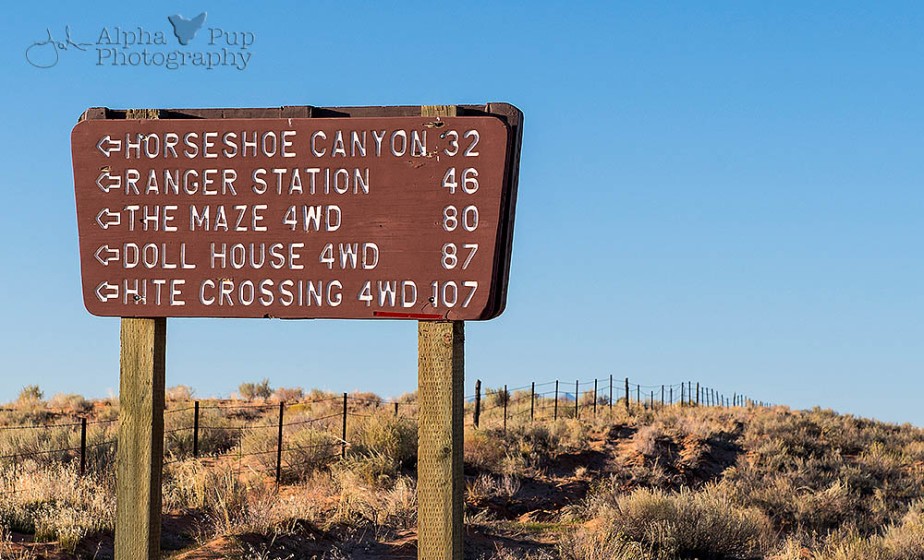
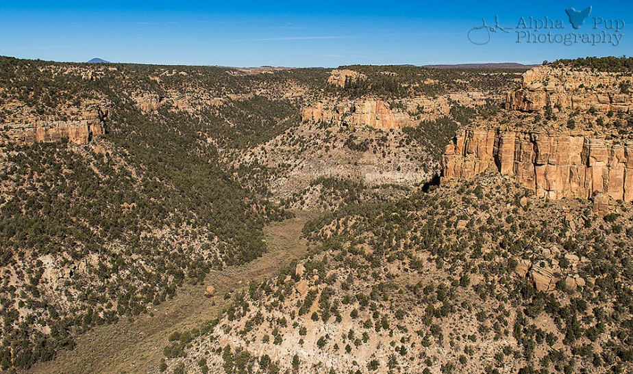
Horseshoe Canyon is located in eastern Utah and is a satellite part of Canyonlands National Park. That doesn’t mean it’s close to anything – it’s just in the middle of nowhere. (Sensing a pattern here with our trips yet?) To reach the trailhead, you have to traverse 32 miles of dirt road that’s only sometimes passable by a 2-wheel drive vehicle with enough ground clearance. 4-wheel drive is recommended, but even then it can be a crapshoot with the road conditions if winds suddenly pick up and bury the road in fine red sand. So, it’s a tricky trek to the trailhead that also requires a touch of luck to make it all the way.
We had more than a little luck on our side the day we attempted our hike. The vicious winds from the day before had died down and didn’t blow too much loose sand on the road. Considering the conditions this road sometimes sees, it was in really good shape. That didn’t make it any less nerve-wracking for my husband doing the driving though. Thankfully we didn’t encounter any iffy areas along those 32 miles on the way in – win! (Getting back to camp we’d deal with later in the day, then breathe easy once we were done.)
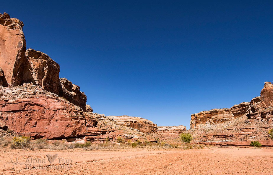
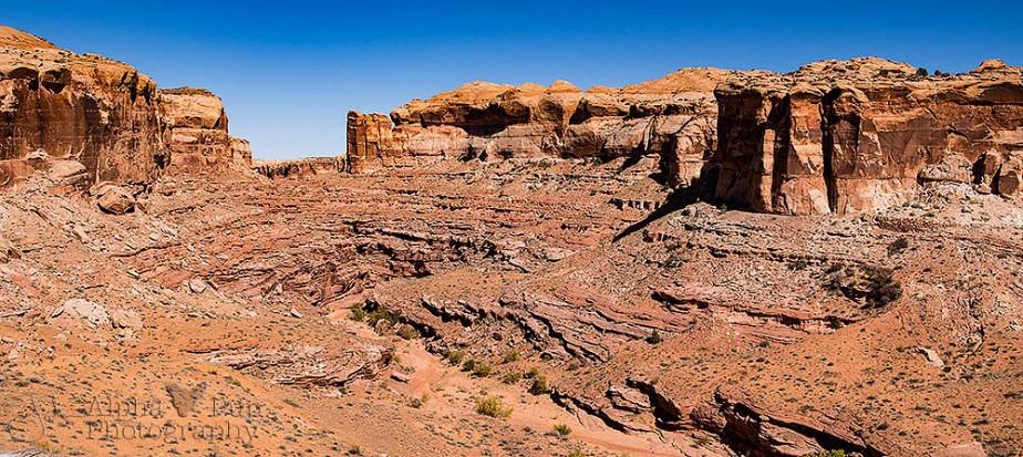
As soon as we reached the trailhead, the canyon was a sight to behold.

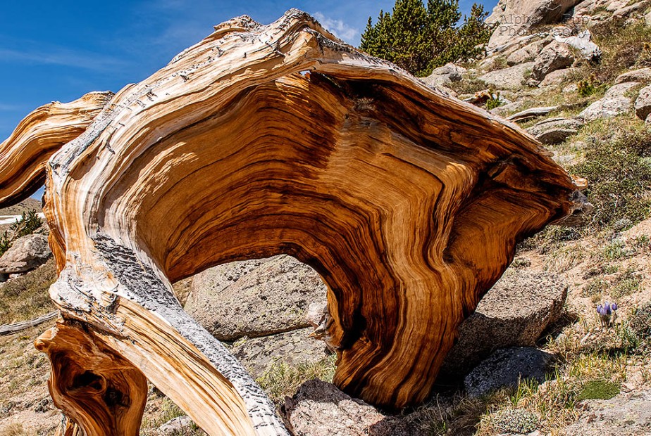
The hike starts with a quick trip down to the canyon floor about 750 feet below. That first mile was full of treats too. We saw some fabulously interesting rock formations, some sort of old watering or irrigation trough, and a dinosaur print! Not too shabby for the first mile.

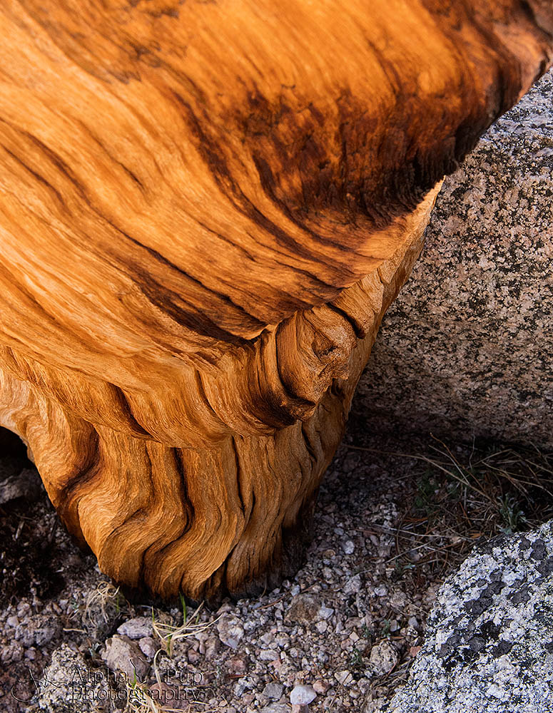
Old Chute

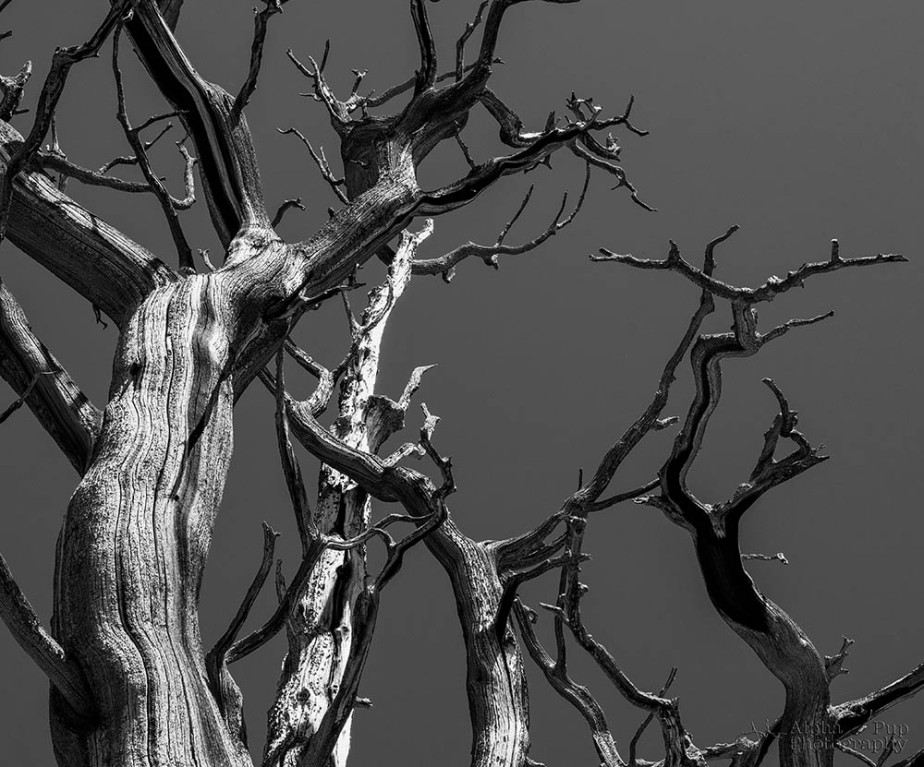
Twisted Rock

Dinosaur Footprint
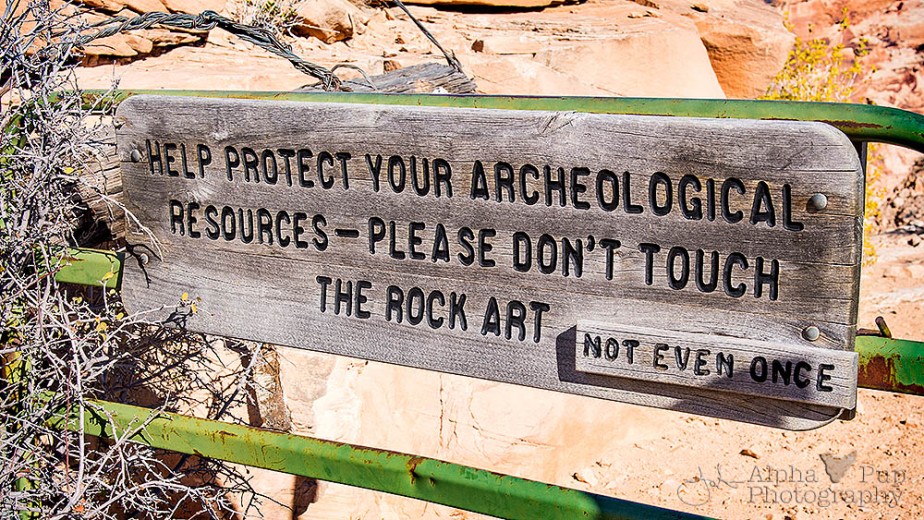
A little further into our descent, we came across a horse gate that is used to limit access via horseback into the canyon. (Access via horseback is by permit only.) . I thought the sign was absolutely fabulous – even if the letters may have been a little too small to drive the point home to some visitors, in my opinion.
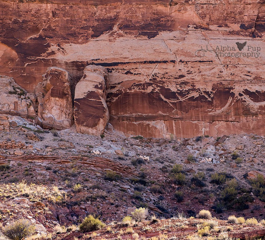
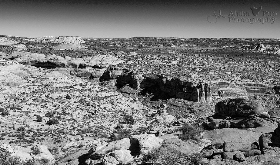
Just past the gate, we were greeted by some of the native burros that live in the canyon. These burros were left in the canyon by the Spanish ages ago and have thrived in the environment since then. They were on the opposite side of the canyon from us, so not close enough to be bothered by our presence (or for me to get a really good picture of them – look for the white & brown creatures near the middle of the picture below).
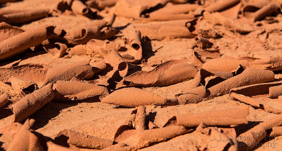
The canyon floor itself became a real treat for my photography eye as we trekked… much to my husband’s chagrin because he came to see the art in the canyon, not be slowed down by me making art. The mud had cracked and curled all over the canyon floor. To me, it looked like a vast expanse of chocolate curls. (Yes, my brain always goes back to food someway, somehow.)
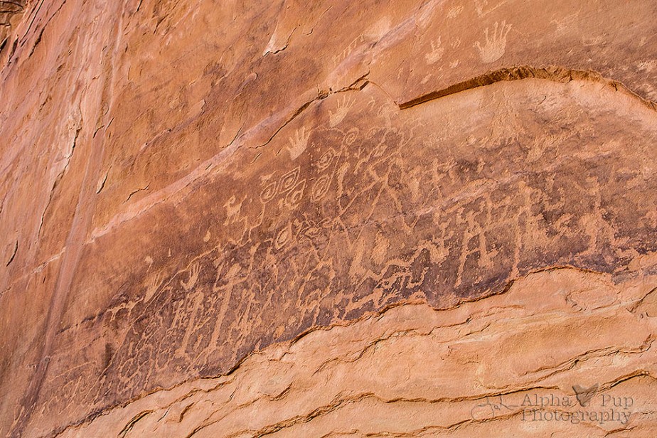
The near-frenetic pace of sights and things I wanted to take pictures of pleasantly surprised us a little. And we hadn’t even reached the first art gallery! Finally, I did put the camera away long enough so we could pick up the pace and we arrived to see what we came for – ancient pictographs & petroglyphs!
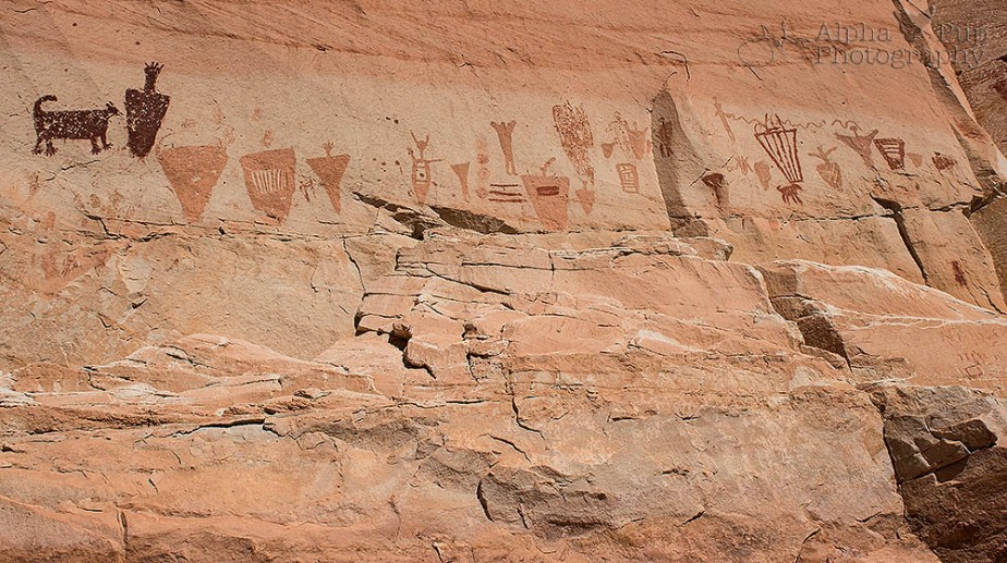
There’s 4 galleries in the canyon with panels that are considered to be the finest examples of Native American rock art in North America. The first gallery we arrived at was the High Gallery. When you see how high up it is, you realize how that panel got its name and then you start to wonder, “How in the world did they get up there to make those images?!”

The High Gallery – Full View

High Gallery Panel
Not too far after the High Gallery, you reach the Horseshoe Gallery. This one was also fairly high up on the canyon wall, but not as much as the previous display. It was also in the sun on light-colored rock, making for a completely different photography challenge for me.
After that one-two punch of the High and Horseshoe Galleries, we meandered through the canyon bottom following the dry stream bed and trail. Thankfully it wasn’t too terribly hot that day since it was autumn, after all. I couldn’t imagine doing that hike in the middle of summer where temperatures would be well over 100. Ugh – too dang hot!
About halfway down to the next gallery, we heard a loud squawking noise in the canyon. We couldn’t believe how loud it was and started looking up for birds. We didn’t see anything in the sky or tucked into the rock walls, so we had a little mystery on our hands. Something to ask the ranger about if we ran into one back at the trailhead at the end of the day.
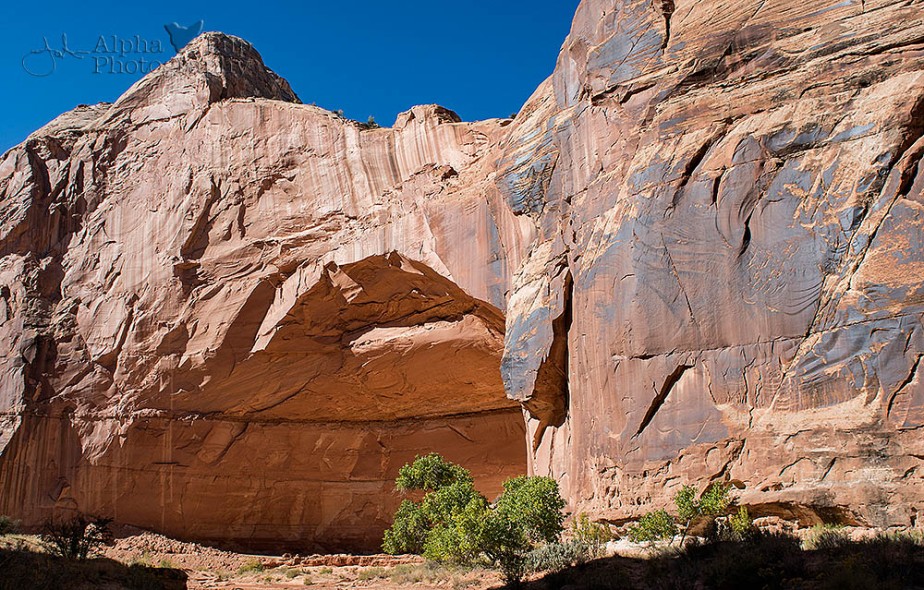
Eventually, we saw a huge alcove that almost looked like the shell of an outdoor amphitheater. That’s precisely when we realized we were nearing the 3rd gallery – the Alcove Gallery.
Where the first 2 galleries were high off the ground, the rock art in the Alcove Gallery was smack at ground level (behind a thin chain fence to deter visitors from touching it, naturally). Being able to get up close to the art was really cool. I was able to get some lovely detail shots of the images. We even noticed places where cowboys coming through the canyon in the 1920s had etched their names in the rock – with pretty decent penmanship no less!

Alcove Gallery Panel

Cowboys Were Here

Alcove Gallery Panel Segment

Alcove Gallery Panel Segment
The grand finale was still about a mile ahead of us. So… trudge, trudge, trudge… walk, walk, walk. That brought us to the Great Gallery. It’s the oldest and most elaborate panel in the entire canyon. This panel is what my husband came to see, and boy did he ever enjoy it! (Click on the pictures to enlarge them & check out the detail of the rock art.)

The Great Gallery in Context

Departing the Great Gallery

Great Gallery Panel Segment

Great Gallery Panel Segment & Rubble

Great Gallery Panel Segment 2
After a spot of lunch, it was time to head back to the trailhead. Since the sun was more or less straight above the canyon, that lit up some of the features that were in deep shadow when we set out on our hike that morning. Yay for me!
Not long after I snagged that 2nd shot above, we heard that squawking again. Only this time it was really, really loud. We had just seen some of the burros on the other side of the canyon and that’s when it clicked – the squawking we heard in the morning at least a 1/2 mile from where we first saw the burros was the burros! Holy hell they’re loud in that canyon!!
Once we got back to the rim and the trailhead, it was time to pack-up and go after a fabulous outing. Before we left, I did snag a quick shot across the canyon up to the northeast since the La Sal Mountains were shining out on the horizon with a fresh coat of snow on their peaks from the storm that passed through the day before.
With the gear stowed, we were off to conquer the 32 miles of dirt road once more. Some sand blew across the road while we were hiking, but thankfully it remained passable. Back at camp we cracked open some beer and celebrated a really good day of hiking and an item successfully checked off of my husband’s “bucket list”.
– JC
")


")